Thursday, September 19, 2013

Pacific Pattern Taking On A Familiar Form

Before I get into the meat and bones of the blog, I have to mention that the verification scores on the global models as of late have been dreadful. The EURO is still scoring best, but not as high as it usually does. I'm not sure exactly why this is the case but the SSW (Sudden Stratospheric Warming) that recently took place over the last month to five weeks or so could be a reason.

For those who remember upper level patterns well, you can recall that this past winter seemed to always feature a large trough over Alaska with a constant upper-level low stalling & spinning in the PAC. NW that would disrupt the flow for the rest of the U.S. It was not until the SSW around mid-January that the 500 mb pattern "relaxed" a bit through most of February and that was when we saw most of our colder than normal and snowier than normal weather conditions along the northeastern U.S.

I can not help but notice that the current 500 mb pattern is heading in a direction similar to what the 2012-2013 winter featured...

Here is 12z EURO at 72 hours:


Trough over Alaska and PAC NW with a temporary one in the eastern U.S. behind a cold front (I will get to the developing -NAO as well later on).

12z EURO @ 120 hours:


Much of the same (besides the -NAO).

12z EURO @ 216 hours:


Again...much of the same.

Here is a zoomed in look at the U.S. from 12z EURO @ 168 hours:


It will be interesting to see how the ENSO and PDO look 4-6 weeks from now. If this pattern persists, it would become apparent we are on our way to another negative PDO winter (not all that surprising since these things come in cycles). The ENSO has been interesting in the fact that it has looked pretty "Nino-ish" to me for much of the summer, which is why I think the hurricane season has been relatively quiet. It still remains in question, at least for me, whether or not this warming trend continues. It is difficult forecasting the ENSO far in advance which is why it is best to focus more on factual data.

Meanwhile, the NAO will be taking an impressive tumble downward, but the lack of Polar Vortex' given the time of year, plus the -PNA (zonal flow) in the west, should keep our temps around average still as we finish off the month of September.

Projected NAO from the GFS...


Have a good day,

Francesco Paparatto


Notes:

--2013-2014 Winter Outlook to be released Thanksgiving Day--

--All images of this blog courtesy of WeatherBell Analytics--

--Come register at the NJ Strong Weather Forum--

http://www.njstrongweatherforum.com/


Tuesday, September 3, 2013

El Nino-Like Conditions Hindering Hurricane Development, Atlantic Not Helping

We are half way through the 2013 Atlantic Hurricane season and there has still not been a hurricane.


What gives!?


One thing I do find interesting is subsurface temps. in the Pacific since mid to late May have been rising. 

The ONI value for June, July, and August is not in yet, but I'm fairly certain it will show a positive (warming) trend in the 3.4-Nino region since real-time data continues to show gradual warmth over that area in the last month. For May, June, and July...the ONI was at -0.2 which is indicative of ENSO-neutral. In fact, "La Nada" has been in effect dating back to March of 2012. Therefore, the ENSO has not had any affect on our weather pattern for the last year and a half! 

Check out the two 500mb anomaly images of the Pacific Ocean from the 12z GFS below. The first one is valid for September 6th and the second one is valid for September 11th. 


Both of these images show positive height anomalies continuing in the Pacific for at least the 1st half of September. There is even constant ridging being shown in the Pacific Northwest of the U.S. (upper right corner of those maps). What this is telling me is the Pacific is undergoing a transition of breaking out of the year and a half long La Nada and trying to emerge into an El Nino state. I can not say with guarantee we are heading toward an El Nino until official reports and observations from the Nino regions prove otherwise. But latest indices are enticing, to say the least. One thing for sure is La Nada will persist through the upcoming fall season. 

How about the Atlantic Ocean? 


The NAO has been positive for much of the summer. Ridging has been concentrated in the central Atlantic, while the northeastern Atlantic (near Greenland) has been under the influence of trough's. Between the ridging in the Pac. NW and the central Atlantic, the eastern CONUS has enjoyed an average Meteorological Summer with episodes of troughs getting into the region. 

This has allowed the SAL (Saharan Air Layer) to remain intact over the Atlantic for much of the season. This GIF taken from WeatherBell will show you what I mean...


The colors represent the dust coming out of western Africa. A new wave of SAL is set to come off of Africa by the weekend. 

Between the combination of westerly winds in the eastern U.S. caused by the constant ridging in the west, the SAL in the Atlantic, and the lack of blocking in Greenland...the hurricane season has not gone as expected thus far in 2013 (even with an MJO favored for tropical development). Additionally, the recent trend of warming in the Pacific has caused the upper level wind flow in the Atlantic to remain unfavorable. 

Speaking of MJO, the EURO wants to take it into the COD (circle of death) by next week:

The only silver lining I see for those who are looking for tropical development is some long range models are trying to push a ridge into the eastern U.S. which would force the ridging over the central Atlantic to propagate east-northeastward. Whether this comes to fruition or not remains to be seen. Also, it only takes one storm to really make a hurricane season one to remember. There is still the 2nd half of September (I'm forecasting 1st half of September to remain quiet) and all of October. We'll see what happens. 

Take care,

-Frank 

Notes:

1. Register to the NJ Strong Wx Forum. Now up to 183 registered members with lots of great minds to share valuable information


2. 2013-2014 Winter Outlook to be released Thanksgiving Day. 


Wednesday, August 21, 2013

A Trip Down Memory Lane: December 26-27, 2010

Got that summertime sadness?

There is not much, weather wise, to talk about for at least the next two weeks. So lets take a look back at one of the most memorable blizzards to strike the NYC Metro area.

December 27, 2010.

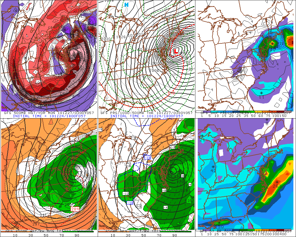
Here was the final snow map for the Boxing Day Blizzard:


This impressive storm dropped 10+ inches of snowfall from North Carolina all the way up into Maine. As you get into NJ, there are widespread 1-2 feet snow amounts and, locally, 30+ inches of snow in northeast NJ and parts of southern NY state.

Here is a close up of the northeast:


What was the most essential factor that put this storm together? The -NAO.


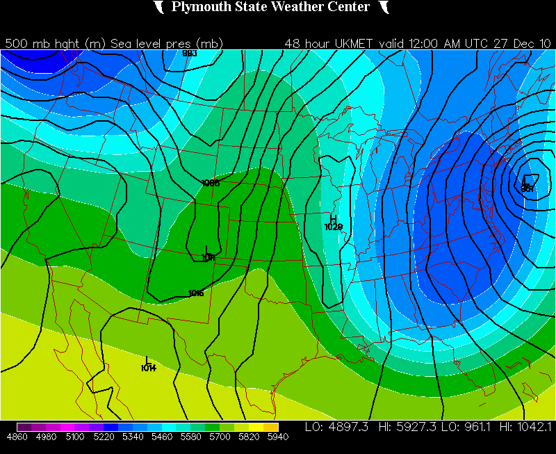
An NAO in a negative state brings positive heights into Greenland which allows the jet stream to dip and create a trough along the eastern U.S. This creates an arctic flow of air to filter into the eastern U.S. Now, compare the graphic above created by TWC with the 500mb map the day of 12/27/10...


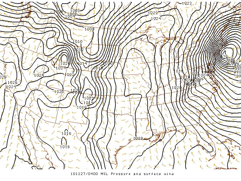
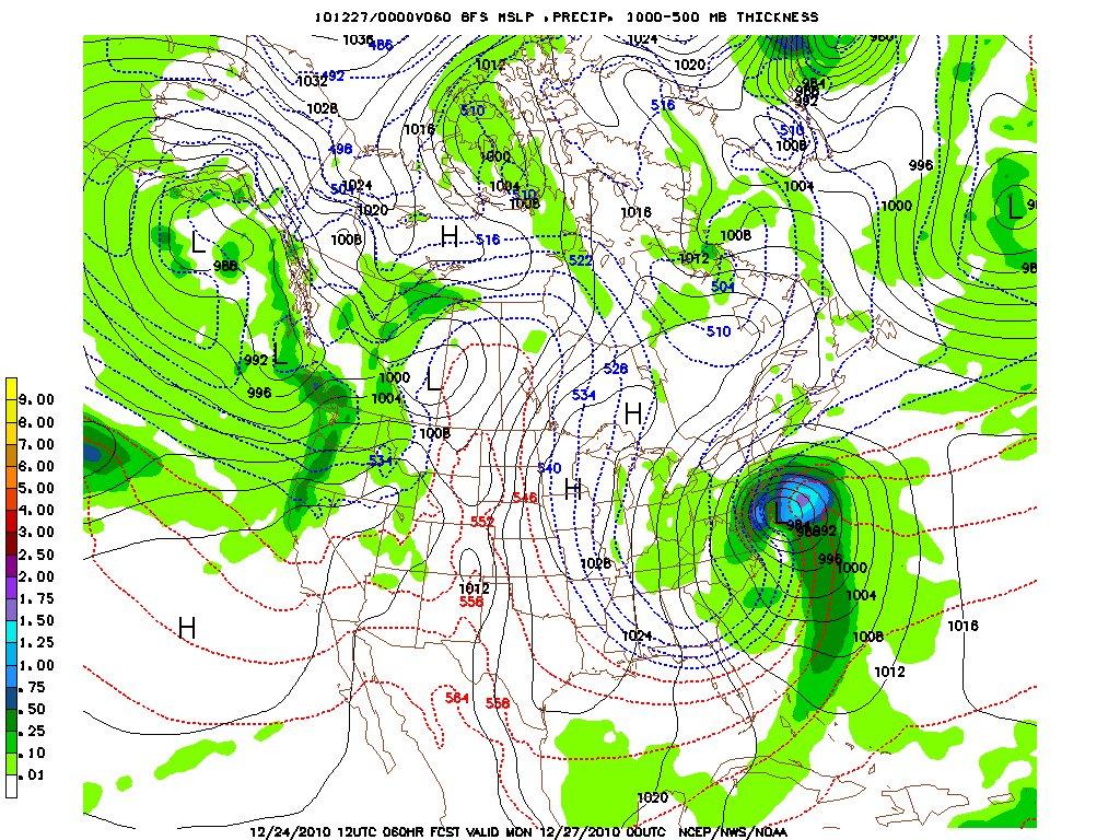
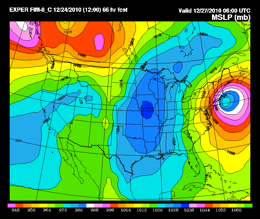
You see that huge trough in the eastern U.S. with low heights extending all the way down into Florida? That is a very amplified pattern of a +PNA, -NAO, and -AO. This looks very much like the TWC graphic. The -NAO allows two bundles of energy to come together which ultimately develops a powerful Nor'easter, in this case known as the "Boxing Day Blizzard" or in my own terminology, a "Godzilla."

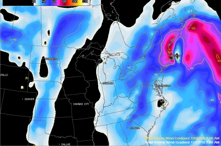
Here are a series of my favorite images or gifs of this historical snowstorm:


Posted Image


Posted Image

Posted Image

Posted Image

Posted Image

Posted Image

Posted Image

And here are some gifs...

http://cimss.ssec.wisc.edu/goes/blog/wp-content/uploads/2010/12/101226-27_g13_wv_anim.gif

http://www.erh.noaa.gov/okx/SOO/case_studies/12262010/sfcir.gif

http://synoptic.envsci.rutgers.edu/riggi/101226_27_kdix.gif

http://www.erh.noaa.gov/okx/SOO/case_studies/12262010/500mb.gif

Have a nice night,

-Frank


Thursday, August 1, 2013

Exactly How "Cool" Will It Get?

By now, we should all be aware of the pattern change that has taken place last week which has ridden the insanely hot temperatures and unbearable humidity. I blogged about it HERE on July 15th...

The biggest reason for this pattern change is due to the abnormally strong PV, or Polar Vortex, this time of year.


The positive heights in the north-central Atlantic, northern Canada, and Greenland...have created an unusual blocking pattern for the commencement of August. Temperature departures relative to average will be between -1 and -4 over the next 10 days or so in the northeastern U.S. and mainly the northern half of the Mid-Atlantic. 

A zoomed in view into the eastern U.S. shows the negative temp. departures from normal nicely. 


In terms of high temperatures, we will be talking mainly 70's (it actually never got out of the 60's today around the Tri-State area due to clouds and rain). Low temps will get into the 50's. Northwestern sections of the of I-95 could see cooler readings, but for the most part, 70's which is still impressive for what are supposed to be the "dog days of summer." 

One thing to also keep in mind is with the battle of positive and negative height anomalies fighting around the mid-section of the country and eventually into the northeast, it could spark the threat for storms to develop. Think of it as a "friction" between the two. It could be enhanced along a front which would develop ahead of the PV that will be situated in southern Canada as it moves on east. 

All in all, 1st half of August should be expected to be cooler than normal with periods of rain at times. The tropics should continue to remain quiet until the 15th. Afterwards, it is beginning to look like fair game for this season to really start picking up as dry air begins to dissipate in the Atlantic. Stay tuned! 

Enjoy your weekend, 

-Frank Paparatto 


Friday, July 26, 2013

Quick Check On The ENSO & Upcoming Winter

ENSO, for those who do not remember, stands for "El Nino/Southern Oscillation." Depending on which phase it is in (hot or cold), will let us know whether we are trending toward an El Nino or La Nina winter. It could also be La Nada, which means neutral. ENSO is one of the most significant factors in formulating seasonal outlooks, especially winter.


The dynamical and statistical models show predominately "La Nina-like" conditions currently in the central Pacific. Further examining of the actual values and taking a mean of those values, however, show mainly La Nada conditions. 

The plumes as of July 1st from the EURO model are trying to show a positive correlation trend begin by August and continue through the fall months. One thing to keep in mind is these plumes change month-by-month and sometimes begin to show different trends, so do not take them verbatim. 

As of now, it is too difficult to tell what the upcoming winter season will feature in terms of ENSO. If I were to look at historical trends dating back to 1950, I would say the upcoming winter season has a good chance of staying around neutral, with some "Nino-like" characteristics. But that will also depend on the PDO and whether or not it can climb out of its negative phase it has been in for quite some time now. 

My 2013-2014 winter outlook can be expected to be released December 1st. Last year, I was with EPAWA when I did the 2012-2013 winter outlook and I had the help of some great Meteorologists, such as Bobby Martrich and Jim Rinaldi, both based out of PA. 

That's all for now. Arrivederci. 

-Frank Paparatto 


Monday, July 15, 2013

6-Day Heat Wave Will Give Way To Prolonged Reprieve

A giant dome of High Pressure situated over the eastern U.S. is going to bring temperatures soaring into the mid to upper 90's in the northeast. Coupled with high humidity levels, this will lead to dangerous and unbearable outdoor conditions. If there has ever been a week to be down the shore, this will by far be the best week to be there. In fact, the last 30 days going back to mid-June have featured above normal temps in the northeastern U.S.


As I stated in my last blog, the Bermuda High is going to stick around for quite awhile and keep our area in a continuous southwesterly flow of gulf warmth streaming into the area. This has indeed been prevalent and has called for frequent days of heat/humidity with occasional days of pop-up rain showers or t-storms. 

The intention of this blog is to bring attention to readers that a pattern change is on the way. The Bermuda High is going to exit stage right which will help upper level trough's entrench themselves over the northeast for the first time in a long time. 

Lets go through a quick look at a couple of models from the 500mb level, starting off with the 12z GFS. 


At 24 hours, this is a clear view of why we are going to be in a 6-day stretch of 90+ degree weather. An area of High Pressure from the tropics has formed over the Ohio Valley region and a "death ridge" has developed over the southeastern U.S. Heat indexes will surpass 100+ degrees and this will surely call for unflattering outdoor conditions. 


As we advance further into the week, at 108 hours, the area of High Pressure has moved east-southeast and a strong upper level low in eastern Canada has helped lower heights over the area and bring temperatures back to normal. One thing also to note: The upper level low in eastern Canada will spawn a cold front, in which we could be dealing with damaging t-storms coming through the northeast. It remains to be seen whether atmospheric conditions are prone for severe weather, but I have a feeling some areas in the northeast by Saturday night into Sunday could be dealing with severe weather. Also notice how a ridge has developed in the western U.S. by this time, allowing northern stream energy to flow downstream into our area which could help spawn off some severe weather. 


By 168 hours, which takes us to early next week, we are still under the influence of a northwesterly flow even though the ridge in the western U.S. has collapsed by this time. 


Looking at the same time frame in the Atlantic Ocean, we can see the Bermuda High is displaced in the central Atlantic and there are positive height anomalies extending into Greenland. The biggest reason for this pattern change is due to the fact that the Bermuda High has finally shifted east. There is now a weakness over the northeast which will allow upper level trough's to get into the area more "fluidly." At the same time, this allows northern stream energy to downstream into the northeast which could call for wetter than normal conditions to get into the northeast by the end of this month. 

The 12z EURO model is in fair agreement of the 12z GFS of this eventual pattern change as evidenced below...


What does this mean? 

1. The heat wave will come to an end Saturday 

2. An MCS may develop Saturday evening into Sunday which could spark severe weather

3. Pattern changes by early next week to average to slightly below average temperatures and potentially wetter than normal conditions. This pattern may persist into early August, until the Bermuda High re-develops again. 

In sum, a break from the heat and humidity is in order. Stay patient and make the best of it for now! 

I'll be back next month with a look at the Hurricane season and when we can expect tropical storms firing up in the Atlantic. 

-Francesco Paparatto 


Monday, July 1, 2013

A Glimpse Into The Long Range

BLOG SONG: "Play Hard" by David Guetta, Ne-Yo, and Akon

Today marks July 1st and a day I believe is a good time to assess the current weather pattern we are in. One thing we have noticed over the last 10 days is the constant humidity and periods of showers and t-storms that  develop in the afternoon and evening hours. The ultimate reason for this type of weather pattern is driven by a phenomena dubbed the Bermuda High, sometimes called the Azores High depending on its location.


A Bermuda High is a permanent area of High Pressure located near, you guessed it, Bermuda. Mind blowing, I know. A reason why it is "permanent" is due to the fact land temperatures are greater than ocean temperatures during the summer time. This means we are constantly under a south-southwesterly wind flow thanks to the clockwise motion of the winds circulating around the High. In terms of weather, this means hot and humid weather for our area sourced by the Gulf of Mexico. 


This is a graphic I made showing much of the east coast of the U.S. vulnerable for showers and t-storms at least for the next two weeks thanks to the Bermuda High. So if you look how the weather has been the last 10 days, you will enjoy the 1st half of July as well. 

This is also well evidenced by the Euro model:


500mb pattern of the 00z EURO model shows the Bermuda High as well as the Pacific ridge (which has caused temperatures in the west to soar into the 110-130 degree mark). One other thing to keep in mind with the Bermuda High is that it prevents low pressure systems from tracking into the Mid-Atlantic and Northeast states. If a low pressure system does manage to get into the area, it weakens dramatically. Therefore, most of our precipitation is tropical related from the Gulf of Mexico under an unstable air mass, allowing t-storms to develop in the afternoon hours of the day. 


A quick look at the sea surface temperatures shows mid to upper 80's in the Gulf of Mexico, which proves why our weather has been so humid thanks to the clockwise motion of the winds from the Bermuda High. Also notice the SST's beginning to warm up in the southern Atlantic and off the west coast of Africa. This is eventually going to lead to an active period of tropical weather come mid to end of August and through September. 

Personally, this is not my type of weather. But once the Bermuda High shifts east again (which will then re-develop a new High called the Azores High), our pattern will change for a 2-3 week period where drier conditions can be expected. I am thinking that happens the end of July. 

Have a great day and a safe 4th of July! Drink responsibly ;) 

Francesco Paparatto